Local Nature Recovery Strategy
We are developing our Local Nature Recovery Strategy (LNRS).
Why we need a LNRS
An LNRS is a way of prioritising nature's needs on a more local and focused level. The strategy is a blueprint for the recovery of nature, showing how and where we can support things like wildflower grasslands, woodlands, wetlands, and new hedgerows across County Durham.
We have been appointed the 'responsible authority' for preparing the Durham Local Nature Recovery Strategy. Responsible authorities will work with other organisations, partners and local communities to identify and agree practical and achievable proposals to recover nature at scale and deliver wider environmental and public benefits.
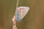
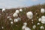
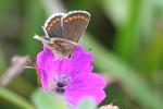
County Durham supports a wide and diverse range of landscape and wildlife, from the blanket bogs and heather of the uplands with iconic species such as the Black Grouse, through the mixed farmland of the Durham Coalfield with remnant ancient woodland and hedgerows to the magnesium limestone grasslands of the coast, home to species such as the Northern Brown Argus and Little Tern. County Durham is also home to the North Pennines National Landscape and internationally designated sites including the Moorhouse and Upper Teesdale National Nature Reserve and Durham Coast.
We rely on nature to support our lives, from the street trees outside our homes to the woodland and wetlands of our nature reserves, nature provides us with the essentials for life. Nature provides us with food, water, carbon storage and clean air. Walks in nature, whether that is in the local park or in the wider countryside, help us stay both physically and mentally healthy.
However, England is widely considered to be one of the most nature-depleted countries in the world and County Durham has not escaped this decline. Our natural environment has deteriorated due to a range of factors, including pollution, pesticide use, invasive non-native species, loss of traditional land management practices and climate change.
The Local Nature Recovery Strategy will help us reverse these losses by setting out where and how to manage our environment to create a network of nature-rich sites which are bigger, better managed and more joined-up.
The LNRS also helps by guiding:
- planning and development: It will guide how and where we plan for new development
- nature-based solutions: It will identify key locations for nature-based solutions for climate change
- health and wellbeing: It will promote the development of accessible nature-rich spaces
- investment: It will help to attract and guide future investment for nature recovery in County Durham
Creating the LNRS
The LNRS will be used to guide and focus funding from a variety of sources, including the government's Biodiversity Net Gain policy, Environmental Land Management schemes (ELM), alongside other potential cross-sector and private funding opportunities such as those for woodland creation, natural flood management, and species projects.
Our strategy will be specific and tailored to County Durham. We can choose how we want it to look, and agree priorities for nature's recovery, map the most valuable existing areas for nature and have specific proposals for creating or improving habitats for nature and wider environmental goals. The LNRS includes:
A local habitat map
The local habitat map will identify the most valuable existing areas for nature and map areas that could be important for wildlife. The habitat map will help direct resources into the best places to deliver nature recovery.
The LNRS statutory guidance sets out a clear definition of the types of sites that we should include in Durhams Areas of Particular Importance for Biodiversity map. These are:
- Internationally designated sites
- Nationally designated sites
- Local wildlife sites
- Irreplaceable habitats
A designated site is a protected area with official status, and in some cases legal protection. Designations are put in place by the government to reflect national or international conservation priorities, and by local government. In addition, habitat that is identified as being irreplaceable is also protected.
This map forms the starting point for Durham's LNRS and will be built upon through the next phases of the LNRS process, to show areas where we should be prioritising nature recovery.
Statement of biodiversity Priorities
This will detail the habitats and species that are the local priorities for nature recovery and provide targets. It will include opportunities, priorities and plans for nature recovery.
Climate change, reducing flooding, and access to nature will all be considered as part of the statement of biodiversity priorities.
Contributing to, publishing and reviewing the strategy
It is important that Local Nature Recovery Strategies are developed alongside our communities and represent the wide range of views, needs and opinions from across County Durham.
The LNRS will engage with a wide range of groups, including residents, landowners, conservation bodies, businesses, schoolchildren, parish and town councils, Area Action Partnerships and community groups.
Over the development of the LNRS there will be an ongoing engagement process, starting with a general consultation for everyone in County Durham. This consultation will start to provide us with information on what broad habits and species groups the residents of the county believe are important and where efforts should be concentrated to improve wildlife habits.
The information gathered over the coming months will help inform a draft of the LNRS which will then go out to consultation before the final strategy is published in Autumn 2025.
It will be reviewed and refreshed every three to ten years (the timescales for reviews have not yet been confirmed by Government).
Please Contact Ecology if you have any questions or want to provide us with further information to help inform the LNRS.
Delivering the LNRS
The Local Nature Recovery Strategy is a plan that will help to guide and coordinate funding for nature recovery projects across the County. One of the key goals of the LNRS is to direct funding through Biodiversity Net Gain (BNG), which is a requirement for most new developments to leave biodiversity in a better state than before the development took place.
The LNRS will identify key priorities and opportunities for nature recovery in the region, such as creating new habitats, and connecting and restoring others. It will also identify specific projects that can be funded through BNG, such as planting hedgerows, restoring wetlands, and creating wildflower meadows.
The LNRS will be used to help guide and focus funding from a variety of sources, including the Government's Biodiversity Net Gain policy, Environmental Land Management Schemes alongside other potential cross sector and private funding opportunities such as those for woodland creation, natural flood management and species projects.
The wider benefits of restoring nature
The wider benefits of restoring nature and creating wildlife habitats are known as 'nature-based solutions'. Nature-based solutions involve working with nature, as part of nature, to address challenges such as climate change and support human health and well-being.
Nature-based solutions can help in reducing climate change and its impacts. Restoring and better managing the landscape can remove carbon dioxide from the atmosphere, as can allowing forests to regrow, restoring peatlands, and switching to restorative agricultural practices. Restoring nature can also help reduce the impacts of climate change, for example, trees in urban areas can cool the air, and creating or restoring wetlands creates natural water reservoirs, reducing the risk of downstream flooding.
More and more academic evidence now exists to show that greener neighbourhoods can lower stress, extend life expectancy, prevent mental ill health and combat air pollution-related illnesses. The NHS now promotes 'Green Social Prescribing', the practice of supporting people to engage in nature-based activities to improve their mental and physical health.
Biodiversity Net Gain
Biodiversity Net Gain (BNG) is a new approach to development that requires that new developments leave habitat for wildlife in a better state than it was before the work took place. BNG will apply to most new developments, unless they are exempt
Whether a BNG has been delivered is partly calculated by the DEFRA Metric, which measures wildlife habitats as 'biodiversity units'. A developer must demonstrate that they have created more biodiversity units than existed before the development.
The relationship between the LNRS and BNG
While BNG should primarily be delivered on the site of the new development, this may not always be possible. In such cases, it can be delivered at an off-site location and the LNRS will be key in identifying these areas.
Landowners and land managers can create or improve wildlife habitats on land under their control and so generate biodiversity units that they can sell to developers. Areas mapped within the LNRS will generate more biodiversity units that can be sold to developers as part of Biodiversity Net Gain when compared to areas that have not been identified by the LNRS. The market represents a potential chance to diversify your income and is expected to be worth £135m - £274m annually.
See also:
- Natural England: what landowners can do now to gear up for the biodiversity net gain market
- Gov.uk: sell biodiversity units as a land manager
The relationship between the LNRS and Environmental Land Management
It is anticipated that the LNRS will be used to help guide and focus funding from Environmental Land Management schemes. The LNRS will enable farmers and land managers to better understand and determine if there are actions that they could undertake that would have particular benefit in their areas. As LNRSs become available across England, central government will look to align funding with the strategies, for example, by considering how applications can support LNRSs.
The LNRS will not designate or legally protect land for nature conservation
The LNRS will not create designations or protections. Its purpose is to help inform land managers and promote nature recovery as a viable alternative to other land uses.
Nature recovery can take place outside the LNRS Mapping
Nature recovery can take place anywhere. The LNRS will identify where evidence suggests it will have the most impact. Funding opportunities will exist for land outside the mapped nature recovery network but recovery efforts within it will receive further financial incentives. For example, there is an uplift applied to Biodiversity Net Gain delivered within the LNRS mapping compared to those areas not specifically mapped by the LNRS.
Linking with planning and development
The LNRS is designed to work with local area planning. The Environment Act 2021 requires that we consider the LNRS when making decisions about both planning policy and development management. It will be a key source of evidence to inform local plans, neighbourhood plans and their reviews. The LNRS itself will not stop planning and does not carry a legal status in the planning process, but it will inform the process.
The LNRS and urban areas
The LNRS will cover the whole of County Durham. Urban areas can be important for wildlife, for example, peregrine falcons and otters both live in the urban environment, and the LNRS will aim to promote the inclusion of wildlife in our these areas, especially as access to nature is important for health and wellbeing.
Urban green spaces could be managed to encourage more wildlife, for example nesting areas for species such as swifts and house sparrows. Introducing nature into urban areas can reduce air pollution and help to mitigate the effects of climate change.
Updates
- November 2023: Governance for the LNRS has been established under the umbrella of the County Durham Partnership (CDP). The CDP is made up of key public, private and voluntary sector organisations that work together to improve the quality of life for the people within County Durham. The production of the LNRS is being overseen by the Ecological Emergency work stream of the Environment and Climate Change Partnership.
- January 2024: Environmental Records Information Centre (ERIC) North East are hosting a LNRS Conference at the Great North Museum: Hancock in Newcastle on Saturday 16 March. The conference will share information on the four LNRS in the region including the Durham LNRS, and present opportunities for you to provide some valuable initial input with a particular focus on species. ERIC North East holds our wildlife data and the recording community's knowledge is vital to help responsible authorities develop their strategies. If you have a specialism in a particular species or species group(s) then the ERIC conference could well be of interest to you.
November 2024: Over the summer months we have been working on identifying the end results that the LNRS is seeking to achieve (Priorities) and specific practical actions to achieve them (Measures). The Priorities and Measures are being drawn up by a series of specialist sub-groups with a wide range of membership from individual species recorders through to organisations such as local angling clubs, Durham Bird Club, Butterfly Conservation, the Durham Wildlife Trust, Wear Rivers Trust, Environment Agency and Forestry Commission. The draft Priorities and Measures should be finished by the end of 2024.
April 2025: The draft priorities and measures were agreed by the Ecological Emergency Board in February. Public consultation was undertaken on those drafts in March, and we are now looking at the feedback and discussing it with partners and specialists to see if any changes to the priorities and measures are required. We are hoping to get a draft LNRS out to consultation in the autumn 2025, so there will be a further opportunity to comment on the LNRS before final publication.
- Email ecology@durham.gov.uk
- Telephone 03000 267 135

 Share this page on Facebook
 Share this page on Twitter
 Print this page


